Abstract
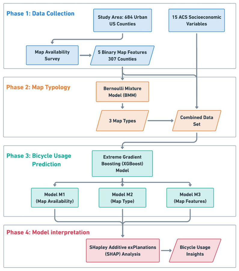
Bicycles are critical to health and sustainability, and promise to play a key role in the decarbonization of passenger transportation worldwide. Yet, while infrastructure investments are well studied, the relationship between bicycle maps (availability and features) and bicycle usage remains largely unexamined. Using the United States as a case study, we surveyed 684 urban counties, finding that only 45% have publicly available bicycle maps online. From these maps, we observed five features: Level of Infrastructure, Amenity Locations, Level of Stress, Transit Locations, and Interactive features. Based on these binary features, we clustered the counties via a Bernoulli mixture model to obtain a typology of three map types. Then using socioeconomic indicators from the American Community Survey as predictors, along with map-related features, we fitted three XGBoost models to predict county-level bicycle mode share, with ranging from 0.45 to 0.58, indicating moderate explanatory power. The models indicate that map availability has a positive association with bicycle usage. Furthermore, we find that detailed maps are associated with lower bicycle usage, while the reverse is the case for simple maps. Finally, of the 5 map features identified, Level of Infrastructure and Transit Locations are the most relevant in explaining bicycle usage but with a negative association. Ultimately, producing maps that emphasize simple and legible design may represent a low-cost strategy to complement infrastructure investments and promote bicycle usage for healthier communities and climate change mitigation.